


Yandex Maps and Navigator
Direct Cursus Computer Systems Trading LLC
I started using Yandex Maps and Navigator as a practical way to make everyday journeys less tiring, especially when I needed more than a simple point-to-point route. It combines map browsing, organization search, directions, traffic information, transport details, and offline map use in one free navigation app. That combination matters when a trip changes halfway through: a road becomes congested, a bus connection looks inconvenient, or I need to find a pharmacy, café, fuel station, or another nearby service without leaving the map.
The app is developed by Direct Cursus Computer Systems Trading LLC and is available for users rated Everyone. Its current version is 29.3.2, and it works on Android 8.0 or later. With over 100 million installs and a 4.0 average from around 1.8 million ratings, it is clearly established rather than experimental. Those figures do not automatically make it the right choice for everyone, though. My strongest impression is that it can be very useful for people who want a broad navigation toolkit, but its value depends heavily on the area covered, the quality of local map information, and how comfortably each person can read and operate a busy map interface.
How Yandex Maps and Navigator handles real-world access
Readability and navigation when attention is limited
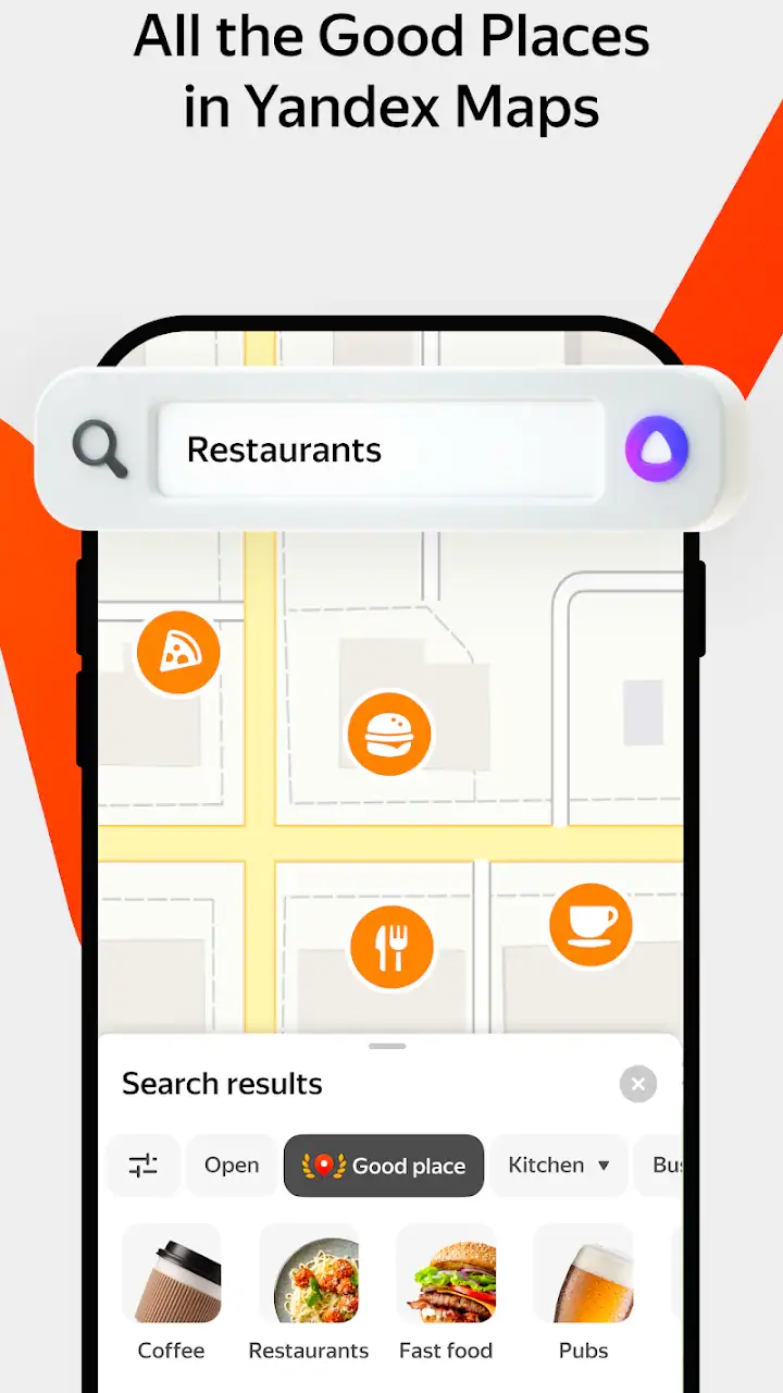
The central strength is the way the app brings several kinds of travel information together. I can search for an organization, inspect its position, ask for directions, and compare driving or public transport options without treating each task as a separate activity. That reduces the mental switching involved in planning a journey. For someone who is unfamiliar with a neighborhood, the ability to begin with a destination rather than a full street address is especially helpful.
Map applications can become difficult when the screen is crowded with pins, roads, labels, and route lines. I found that the most comfortable approach is to decide what I need before zooming around. If I am looking for a business, I search by name or type first. If I am checking a route, I enter the destination and then return to the map only when I need to understand the surrounding streets. This workflow is easier to follow than dragging around a wide city view and trying to identify the correct marker visually.
The useful accessibility idea here is reducing decisions, not simply displaying more information. A person with limited attention, reading fatigue, or difficulty processing a dense screen may benefit from handling one task at a time: find the place, select the route, then check the immediate surroundings. The app supports that approach naturally because its map, organization search, and directions are connected.
Related News

Why WhatsApp Messenger Still Makes Everyday Communication Feel Easy

Jurassic World: The Game Is the Better Dino Tycoon for Strategic Players

Threads in Real Life: Who Should Join, Lurk, or Leave

How SHEIN Turned Shopping Into an Endless Content Feed

How to Make Fortnite Feel Smarter on Mobile

Should You Switch to Microsoft Outlook on Mobile?
For drivers, the Navigator side is most valuable before moving rather than while trying to make complicated changes on the road. I prefer setting the destination, checking the proposed path, and reviewing traffic conditions before departure. That small preparation step prevents the common problem of trying to interpret several route choices under pressure. If I need a different destination later, I stop first. The app can help with navigation, but it should not encourage anyone to operate a phone while driving.
Public transport planning is useful in a different way. A route is not only a line between two points; it can involve walking, waiting, transfers, and a final approach to the destination. Seeing transport information alongside the map helps me judge whether the trip is realistic for my energy, mobility, or time constraints. A route that looks short on the screen may still be uncomfortable if it involves several changes or a long walk between stops.
Offline maps are another important part of the experience. I see them as preparation rather than a complete replacement for connected navigation. Before leaving an area with unreliable coverage, downloading the relevant map can preserve basic map access and reduce dependence on a live connection. I would still prepare carefully, because live traffic and changing transport conditions are different from the underlying map itself. Offline use is most reassuring when I already know the general route and need a dependable reference rather than constant updates.
Gallery
Motor, visual, and sensory considerations
Map navigation places several demands on the user at once: reading small labels, selecting controls accurately, interpreting color and line direction, and keeping track of movement. That makes the app more manageable when I use it in short sessions. I zoom in before selecting a place, avoid unnecessary map gestures, and confirm the destination name before beginning. These habits reduce the chance of tapping a nearby result or starting a route to the wrong branch of an organization.
For users with limited fine-motor control, map dragging and pin selection can be frustrating. A small movement may shift the map instead of selecting the intended location, particularly when several places are close together. Searching by organization name or address is generally a better method than trying to place a pin precisely with a finger. I also find it easier to make route changes while stationary, with the phone supported rather than held in one hand.
Visual comfort varies widely. A route map can be understandable at one zoom level and overwhelming at another. I usually keep the view focused on the next meaningful part of the journey instead of displaying a whole metropolitan area. That makes turns and nearby landmarks easier to distinguish. People who rely on enlarged text or strong contrast should judge the interface on their own device, because screen size and system display settings can change the experience considerably.
I would not treat a map as a substitute for environmental awareness. Screen-based directions may not make a curb, temporary obstruction, crowded crossing, steep slope, or confusing entrance obvious. This is particularly important for people with low vision, balance difficulties, hearing loss, or sensory sensitivities. The app can identify a destination and suggest a route, but it cannot guarantee that every part of the physical environment will be comfortable or accessible.
Sound and vibration can be helpful to some people and distracting to others, especially in busy streets or noisy vehicles. I prefer checking the route visually before leaving and using the phone as a supporting reference rather than depending on one sensory channel. Someone who cannot comfortably hear spoken guidance may need to rely more on the map and visible instructions. Someone who finds visual information tiring may need regular pauses and a safer place to stop and check the screen.
One practical tip is to use the app for orientation in stages. I might first identify the destination, then check the route to a major landmark, and finally confirm the last section once I am nearby. This is less demanding than trying to memorize every turn at once. It also helps when a person is anxious about unfamiliar travel, because each decision is limited to the next manageable step.
Situational access beyond the ideal journey
The app becomes more useful when circumstances are imperfect. If I am late, traffic information can influence whether driving is sensible. If I am in an unfamiliar district, organization search can replace the need to know an exact address. If mobile coverage is uncertain, offline maps provide a layer of preparation. These are not rare edge cases; they are the moments when navigation tools either reduce stress or add to it.
Consider a realistic afternoon trip. I need to visit an organization across town, but I am not sure whether driving or public transport will be less demanding. I search for the organization, inspect its location, compare available directions, and look at the final approach on the map. If the public transport route requires an awkward transfer, I can recognize that before leaving. If I choose to drive, traffic information helps me decide whether to leave earlier. If the return journey may take place in an area with weak connectivity, I prepare an offline map first.
That workflow is particularly valuable for people who need predictable transitions. A person managing fatigue may want to avoid unnecessary walking. Someone traveling with a child may prefer fewer changes. A user with sensory sensitivities may want to identify a quieter route or at least understand where the complicated parts of the journey occur. The app does not make those judgments for me, but it gives me enough map context to make a more informed personal choice.
It is also useful for people who are not confident with local geography. Instead of remembering a long list of street names, I can use the map to relate the destination to recognizable roads and nearby organizations. This supports independent travel, although I still recommend checking the route before setting out. A map can show a logical connection that feels very different on foot, especially around large buildings, divided roads, entrances, or transport hubs.
Compared with a basic map viewer, this app feels more action-oriented because searching, routing, traffic, transport, and offline preparation sit close together. Compared with a dedicated driving navigator, its broader organization search and public transport context may be more useful when a journey includes several types of travel. On the other hand, people who want the simplest possible interface may prefer a less feature-heavy alternative. More information is helpful only when I can find the right information quickly.
The free price makes it easy to try without committing money, which is important for users who need to test readability, route clarity, and local coverage on their own phone. I would not choose it solely because it is free, however. A navigation app has to work in the places I actually visit. I would test a familiar route, a nearby organization search, and an offline area before relying on it for an important trip.
Where access still meets barriers
The biggest limitation is that digital navigation cannot fully describe physical access. A route may be geographically correct while still being unsuitable for a wheelchair, walker, cane, stroller, or person who cannot manage stairs. A destination marker may lead to a building without making the best entrance obvious. A public transport route may be possible in theory but difficult in practice because of crowded platforms, long walking connections, or changes that are hard to manage.
For that reason, I treat the app as a planning aid rather than an accessibility guarantee. When the journey matters, I verify the final entrance with the organization, inspect the surrounding streets in advance, and allow extra time for finding the correct approach. This is one of the most important distinctions between knowing where a place is and knowing whether reaching it will be comfortable.
Dense map information can also create cognitive friction. A user may see several nearby organizations with similar names, multiple route options, and changing traffic details. That is useful for comparison but tiring when the goal is simply to get somewhere. I recommend choosing a single destination result carefully, checking the address, and avoiding repeated route changes unless the situation genuinely requires them.
Offline use has a similar trade-off. It can reduce dependence on connectivity, but preparation is required, and offline information should not be assumed to reflect every live change. I would download the area while connected, confirm that the destination appears correctly, and keep a simple backup plan for critical journeys. A screenshot, written address, or note about the final entrance can be more useful than discovering a problem after leaving coverage.
There is also a personal safety barrier. Looking at a phone while walking can reduce awareness of traffic, bicycles, uneven surfaces, and other people. I prefer stopping in a safe place to read the map, then walking again. For users with balance or vision difficulties, this matters even more. The best navigation routine is not the one that gives the most instructions; it is the one that lets the person remain aware of the environment.
People who need highly specialized accessibility information should be cautious about making assumptions from any general-purpose map. If step-free access, accessible toilets, quiet spaces, or a particular entrance is essential, I would confirm those details directly. The app can narrow the search and support planning, but personal confirmation remains necessary for high-stakes or unfamiliar trips.
My inclusive verdict after using it
I recommend Yandex Maps and Navigator to people who want one free Maps & Navigation app for finding organizations, planning driving or public transport journeys, checking traffic, and preparing for offline use. Its strongest inclusive quality is flexibility: I can adapt the workflow to my attention, mobility, confidence, and connection needs instead of using the map in only one way. The large user base also suggests that it is a mature option worth testing, while the 4.0 average shows a generally positive but not flawless reception.
I would especially suggest it to travelers who move between different transport modes, drivers who want traffic context, and users who often need to locate organizations rather than only follow saved addresses. It can also help people who feel more independent when they can preview a route, break it into stages, and prepare an offline map before leaving. The ability to plan around energy and uncertainty is more valuable to me than simply seeing a blue line on a screen.
I would be more cautious about recommending it to someone who needs guaranteed step-free routing, highly detailed accessibility information, or the least visually demanding interface possible. In those situations, a specialized accessibility resource, direct confirmation from the destination, or a simpler navigation alternative may be better. I would also skip making it my only plan for an important journey until I had tested local map coverage and the way route information appears on my device.
Overall, I see this app as a capable planning companion rather than an authority on real-world access. Its search, directions, traffic, transport, and offline tools can remove several common barriers, particularly when I prepare before moving. The most successful experience comes from using those tools deliberately: search instead of precision tapping, inspect the final approach, download maps ahead of time, and pause safely when checking the screen. For everyday navigation with room for personal judgment, it is a worthwhile free choice.
In my experience, the best reason to install it is not that it promises to solve every travel problem. It is that it gives me several ways to understand the same journey. That matters when a route has to fit a person’s energy, senses, mobility, attention, or surroundings. Used with those limits in mind, Yandex Maps and Navigator can make unfamiliar travel clearer and more manageable without pretending that a digital map can replace local knowledge or human judgment.
FAQs for Yandex Maps and Navigator
What features does Yandex Maps and Navigator offer for navigation?
Yandex Maps and Navigator provides turn-by-turn navigation, real-time traffic updates, and voice guidance. It also offers route planning with multiple stop options and alternative routes to avoid congestion. Users can explore detailed maps, view public transport routes, and access offline maps for areas with limited connectivity.
How accurate is the traffic data on Yandex Maps and Navigator?
Yandex Maps and Navigator uses real-time traffic data sourced from various inputs, including user reports and GPS data, to provide accurate traffic conditions. This helps in offering optimized routes to avoid delays. While accuracy is generally high, users should be aware that rapid changes in traffic conditions may affect real-time updates.
Can I use Yandex Maps and Navigator offline?
Yes, Yandex Maps and Navigator allows users to download maps for offline use. This feature is particularly useful in areas with poor internet connectivity. However, downloading maps requires storage space on your device, and some features, like real-time traffic updates, will not be available offline.
Is Yandex Maps and Navigator available in multiple languages?
Yandex Maps and Navigator supports multiple languages, catering to a diverse user base. The app automatically detects your device's language settings to provide a seamless experience. Users can also manually select their preferred language from the app settings to ensure ease of use while navigating.
How does Yandex Maps and Navigator ensure user privacy?
Yandex Maps and Navigator prioritizes user privacy by implementing robust data protection measures. The app collects data for improving navigation services but maintains strict privacy protocols. Users have control over their data preferences and can manage permissions through the app settings to ensure transparency and security.
Pros
- Accurate real-time traffic updates.
- Detailed offline maps available.
- Intuitive and user-friendly interface.
- Comprehensive public transit info.
- Voice-guided navigation in multiple languages.
Cons
- Limited coverage in some rural areas.
- Occasional delay in traffic data updates.
- Heavy battery usage during navigation.
- Ads can be intrusive at times.
- Some features require a constant internet connection.


